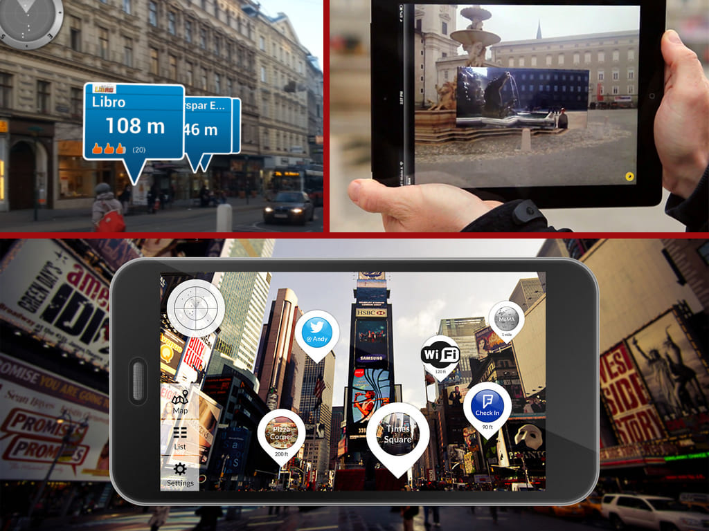
Ever since Pokemon Go was released and now is 2025 gained huge attention and an engaging gaming experience among youngsters, Location-Based AR has become the prime center for developers and Investors in Information Technology.
Finding Locations and guiding user navigations have become easy and helpful due to the advancement of Google’s Map apps.
Location-based augmented reality facilitated numerous application developments, especially in live deliveries of food apps and path navigations.
A combination of these engaging Gaming, location and Live-Guide with currently happening augmented reality application development is the best thing and the need of the hour of present and for the future.
Challenges of Location-Based AR:
It’s not like the typical Marker-based AR apps, where we know to place AR content on top of the marker-image. It’s kind of a Marker-less AR.
Here Location is the marker point. So, developers have to put a lot of effort into making sure, the location tracking and the augmentation of contents work as perfectly as possible for location-based augmented reality.
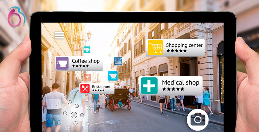
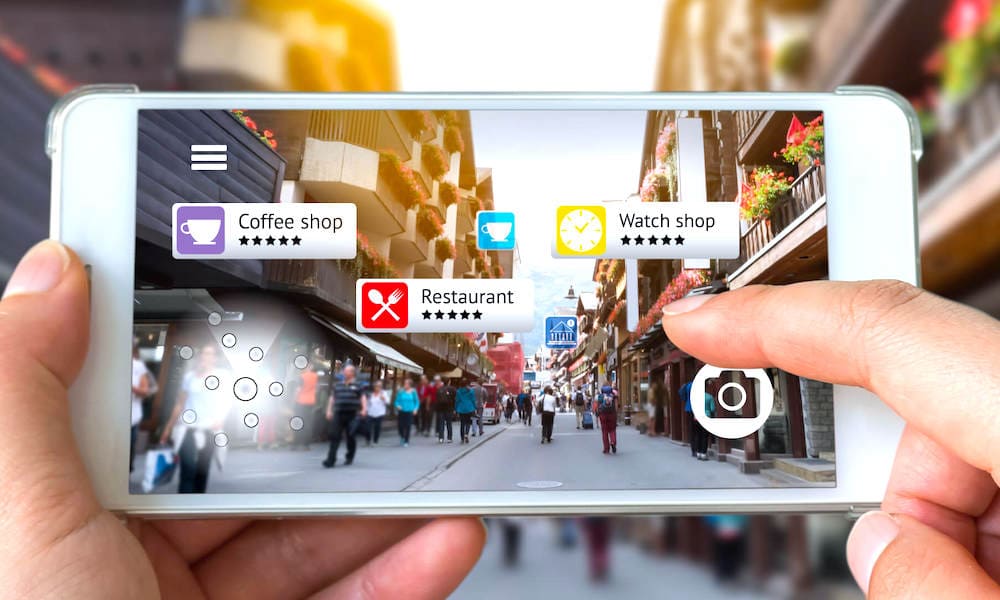
The mobile and the app have to define the location of the physical object (e.g. building, road, footpath, and lake), calculate distance and attach an AR object (sign, text, image or a video). Simply overlaying on the digital element won’t do the trick.
It has to be placed accurately, stick tightly, remain stable, and not jiggle when the user is moving or changing angles. But achieving such a high level of accuracy is not possible only with mobile phone’s GPS alone. It requires a stable yet a complex solutions and SDKs.
Wikitude
Wikitude is one such AR framework that provides a Geo-based AR SDK for leading mobile platforms. The SDK works based on GPS, compass, and Accelerometer.
For outdoor purposes, it uses GPS signals and for Indoor, the SDK uses Beacons. Currently, this framework is available for iOS, Android, and for certain Smart Glasses. Wikitude provides the following location-based ar services through their SDK.
Geo-Location Scenes
Geofence Triggers
Radar UI Element
Relative Locations
Distance Based Scaling
The only concern with this SDK is the cost. Yes, it costs around $2800 for getting the license of this Geo-SDK.
Mapbox
Mapbox is a Live-Location Platform that has a set of tools for developing AR-navigation Mobile apps with Data visualization. They provide online portals for registering yourself and getting their SDKs and libraries. Currently, Mapbox SDKs are available for iOS, Android and Unity3D.
The developer and Users can create their own custom styles in the way they want to present the maps in the app. Using Mapbox APIs, we can search for locations and best routs.
The framework provides the fastest geospatial data. We can create Points of Interest (POIs) and place AR content for each location.
The best thing about this SDK is the cost It’s very cheap, almost free for up to 50000 map views per month. And the real-time renderer or the physical objects such as buildings and roads are simply great for the gamification aspect.
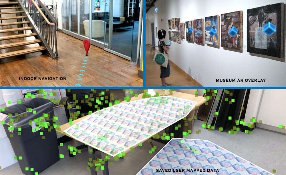
Placenote
Placenote SDK is mostly used for Indoor and small-scale location-based apps such as Malls, museums, campuses, and tourist attractions.
Unique thing about this SDK is that the users can map their location and position. They can put their memories as metadata. This information can be saved for future purposes. AR objects can be overlaid for the physical objects and locations.
Did you find this article useful? Let us know by leaving a comment below, or join us on Twitter and Facebook.